




Someone typed one sentence and put a nuclear plant in Iran. That was Thursday, and by Friday the feature that let them do it was gone: AI image generation inside Google Earth, live on 30 July, rolled back on 31 July. It ran Nano Banana 2 over real satellite and 3D imagery of real coordinates, which is the thing that made it different from every other image generator, and also the thing that made it a problem. Every image carried a SynthID watermark. We went looking for what that watermark actually does once the picture leaves Earth and lands on X, and the answer is thinner than the press line suggests.
The short answer
Google put Nano Banana 2 image generation into Google Earth on 30 July and pulled it on 31 July. The feature painted prompts over real satellite imagery of real coordinates, and researchers had fabricated war scenes on named locations within hours. The watermark story is the part worth keeping: SynthID is invisible, it has to be actively checked, and at least two testers reported it failing to flag a fake.
What shipped, and for how long
Google Earth on the web, 30 July, available globally. You pick a spot in satellite or 3D view, hit create image, and describe what you want. Google’s own examples were harmless and genuinely nice: render these Pompeii ruins as they looked in 78 A.D., turn the Mountain View campus into a futuristic sci fi utopia. Urban planning renders. Historical reconstruction before a site visit.
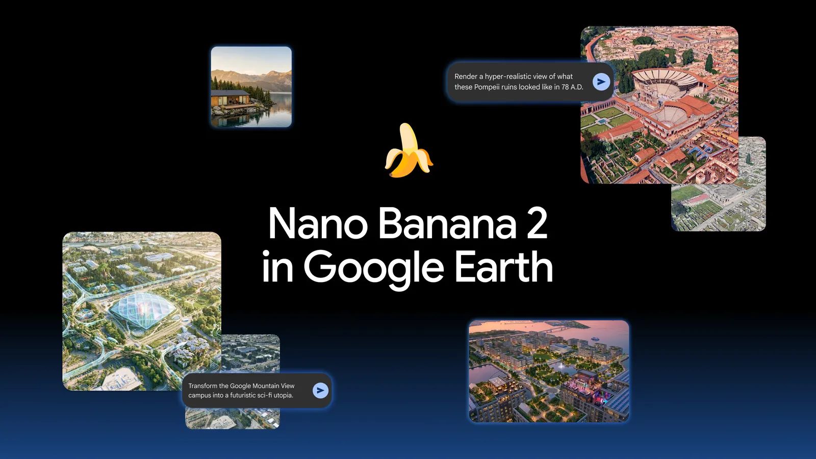
Image: Google (announcement post for Nano Banana in Google Earth, 30 July 2026)
The word Google leaned on was grounded. Generation starts from Earth’s real imagery of the actual coordinates, so the output looks like that place, from that angle, with that terrain and that street layout. Plenty of image models shipped in July, FLUX 3 and Seedream 5.0 Pro among them, and none of them start from your coordinates. That grounding was the product.
It was also the failure mode. Here’s Google, rolling it back:
We’ve seen geospatial professionals using this feature for a range of useful purposes, however we’ve also seen people sharing screenshots of generated imagery that appear to violate our policies. We’re rolling back this feature in Google Earth while we work on implementing stronger guardrails.
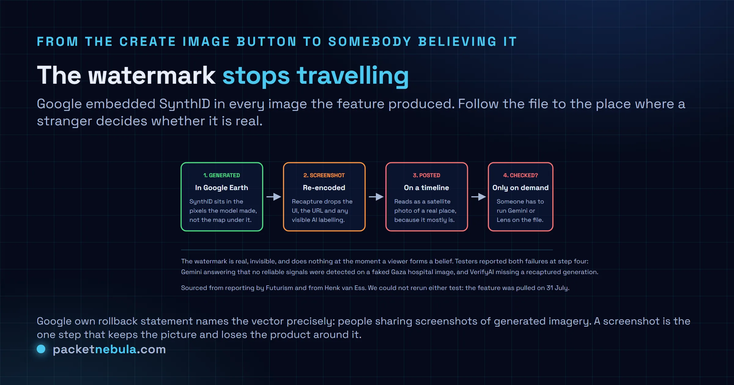
Sharing screenshots. One word in that sentence is doing all the work.
The demos took hours, not days
Henk van Ess, a Dutch open source intelligence researcher, published on 30 July under the title “How to plant a nuclear plant in Iran”. One sentence each: refugees near the Mexican border, a nuclear facility on Iranian ground, a fatal crash on an Amsterdam street, a hospital with a bomb crater in Gaza.
Then everybody else. BBC Verify produced a toppled Eiffel Tower, a sinkhole at the Great Pyramid of Giza, Russian tanks in Kyiv. AFP generated explosions in Paris. 404 Media put skyscrapers on farmland and an encampment into Los Angeles. Futurism ran a Pennsylvania town on fire and full of soldiers, plus a crater in the Kremlin.
None of that was a jailbreak. That was the feature working.
The watermark, and why it didn’t hold
Google’s answer to all of this, before the rollback, was SynthID: an invisible watermark embedded in every image Nano Banana generates in Earth. Two things went wrong with it, and only one of them is technical.
Coverage first. Reporting on van Ess’s tests says the watermark lives in the generated pixels, not in the authentic satellite imagery around them, and in the examples he checked that generated portion was under a quarter of the frame. A detector looking at the whole picture is looking mostly at a real map.
The bigger one is that detection is an action, not a property. You upload the file to Gemini, or you run Google Lens, and then you find out. Nobody scrolling X does that. When people did check, results were mixed at best: Tal Hagin put a faked Gaza hospital image to Gemini and got back that no reliable signals were detected indicating how the content was created. Van Ess re-captured one of his own generations and reported VerifyAI failed to recognise it.
We can’t reproduce either test now, because the feature is gone, so those are reported results rather than ones we ran. Both come from people who do this work for a living.
What to take from it if you build anything
Watermark based detection is not a control you can lean on. If your product accepts user uploaded imagery and your plan for authenticity is “we’ll check the watermark”, that plan assumes the file reached you intact, that the watermark covered enough of it, and that somebody runs the check. Three assumptions, and the last one is the one that always breaks.
Provenance that has to be requested is provenance that mostly doesn’t happen. The signed alternative, C2PA manifests, is better in principle and still gets stripped by every re-encode and most upload pipelines. I don’t think there’s a clean answer here yet, and I’m suspicious of anyone who says otherwise.
The other lesson is about surfaces. Google Earth carries decades of accumulated trust as a record of what is actually there. Bolting a generator onto that surface transferred the trust to the output for free, which is what van Ess meant when he wrote that the output inherits the credibility of the map it was born on. Ship a generator on your own trusted surface and you’re lending it your reputation, not the other way round.
The part that outlasts the rollback
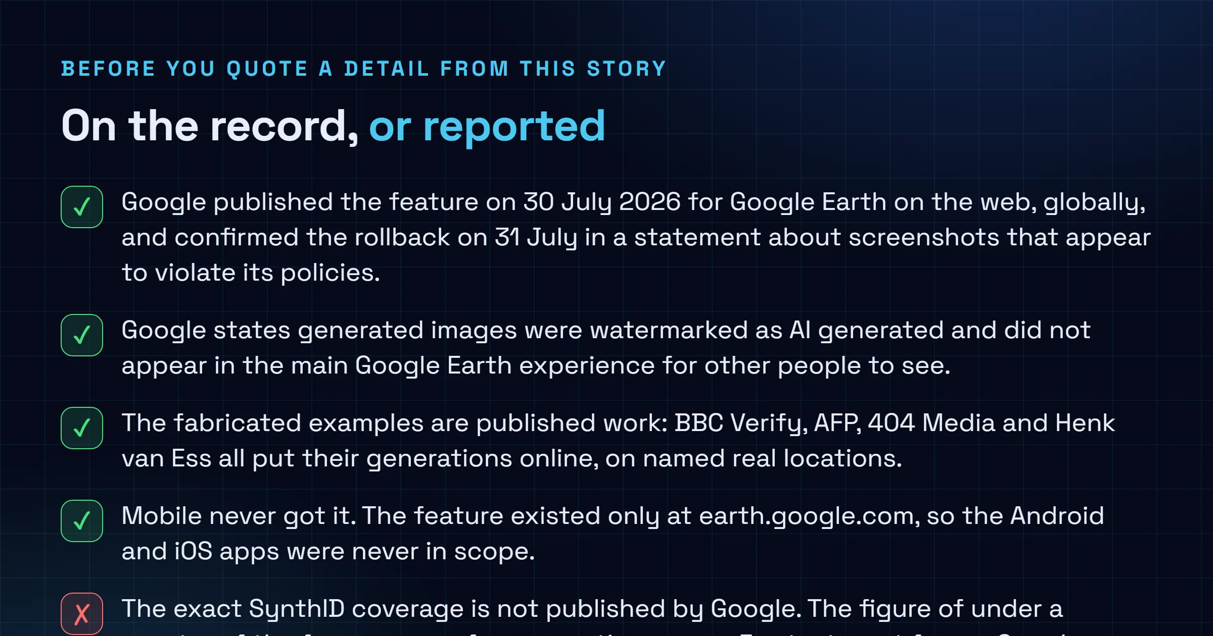
The base archive was never touched. Google says generated images did not show up in the main Earth experience for other users, and nothing in the product today carries a stranger’s prompt. That matters and it’s worth saying plainly.
What doesn’t get rolled back is the knowledge that the tool existed. Van Ess put it better than we can:
An official can now look at a genuine photograph of a genuine atrocity and say: AI. He doesn’t need the tool for that. He needs everyone to know the tool exists.
Google says guardrails are coming. No date. If it comes back, the question to ask isn’t whether the images are watermarked, because they will be. It’s whether anything travels with the file that a person sees without being asked to look.
Sources
The feature description, the availability, the use cases and the note that generated images were watermarked and did not appear in the main Earth experience come from Google’s announcement post, Transform any place with Nano Banana in Google Earth, dated 30 July 2026. The rollback and Google’s statement are reported by TechCrunch, 31 July 2026. The van Ess demonstrations, the quoted conclusion and the VerifyAI result are from his post How to plant a nuclear plant in Iran, 30 July 2026. The BBC Verify, AFP and 404 Media examples and the description of SynthID are via The Next Web. The Tal Hagin Gemini test and the additional fabricated examples are via Futurism.
Frequently asked questions
What was the Google Earth AI image feature?
Launched on 30 July 2026 on Google Earth for web, worldwide. You picked a location in satellite, aerial or 3D view, hit create image, and typed a prompt. Nano Banana 2 then generated a scene grounded in Google's real imagery of those coordinates. Google pitched it for historical reconstruction, urban planning renders and educational infographics, and it stayed live for about a day.
Why did Google roll it back?
Google's statement says it saw geospatial professionals using the feature usefully, but also saw people sharing screenshots of generated imagery that appeared to violate its policies, and that it is rolling the feature back while it works on stronger guardrails. Within hours of launch, researchers and newsrooms had published fabricated scenes layered on real places: a nuclear plant in Iran, Russian tanks in Kyiv, a bomb crater at a hospital in Gaza.
Does the SynthID watermark prove an image is AI generated?
Not on its own, and not reliably here. SynthID is invisible and has to be checked, either by uploading the image to Gemini or through Google Lens, so it only works when somebody takes that step. Reporting on Henk van Ess's tests says the watermark sits in the generated pixels rather than the untouched map around them, which in his examples was a minority of the frame. Tal Hagin fed a faked Gaza hospital image to Gemini and got back that no reliable signals were detected indicating how the content was created.
Is Google Earth's own satellite imagery compromised?
No. The base archive was never modified. Google states generated images did not appear in the main Google Earth experience for other people to see, so nothing you look up in Earth today has a stranger's prompt baked into it. The damage was in what left the product as a screenshot, carrying Earth's visual credibility without Earth's labelling.
Is the feature coming back?
Google says it is working on stronger guardrails and has not given a date. Read the wording carefully: it is a rollback while guardrails are built, not a cancellation. If it returns, the thing worth checking is whether provenance travels with the file instead of waiting for someone to ask a chatbot about it.